They are enormous birds, but when you see them in their native habitat, in Colca Canyon, they look almost tiny compared to the grandeur of the landscape.
Until they sweep noiselessly by you only a few feet away.

Then you see how big they really are. Their wingspan is almost ten feet, they stand three-and-a-half feet tall, and weigh up to 26 pounds.
But their habitat is huge, too. Colca Canyon is 10, 725 feet deep, more than twice as deep as the Grand Canyon. It's about 100 miles on narrow, twisting, sometimes dirt roads from Arequipa.
We got up before 2 am for a 3 am pickup on a bus tour that didn't show up until nearly 4 am. The trip takes three hours, but I think the drivers really wanted to make up time, so we hurtled through the dark, often passing very slow trucks on blind corners, then stopping dead for no evident reason. At one point we had to leave the road entirely to get around a jack-knifed big rig where an emergency crew was working frantically under ominously flashing lights. The bus had so little heat that frost formed on the inside of the windows.

Eventually, though, we reached the valley, winding along the river past verdant terraced fields.
The condor viewpoint is at 12,000 feet. The air is cold, but the sun is quite warm. Our guide cautioned us that we might not see any condors, but we were lucky enough to see at least a dozen, basking in the morning sun or riding the thermals rising from the deep canyon.
The sun felt good after the frigid bus ride.
At each stop, there were hawkers selling souvenirs and refreshments. O and I bought some juicy, peeled cactus fruit, tart and refreshing. Later in the trip I had a pisco sour made from the same fruit. It was delicious, and at that altitude, quite intoxicating.
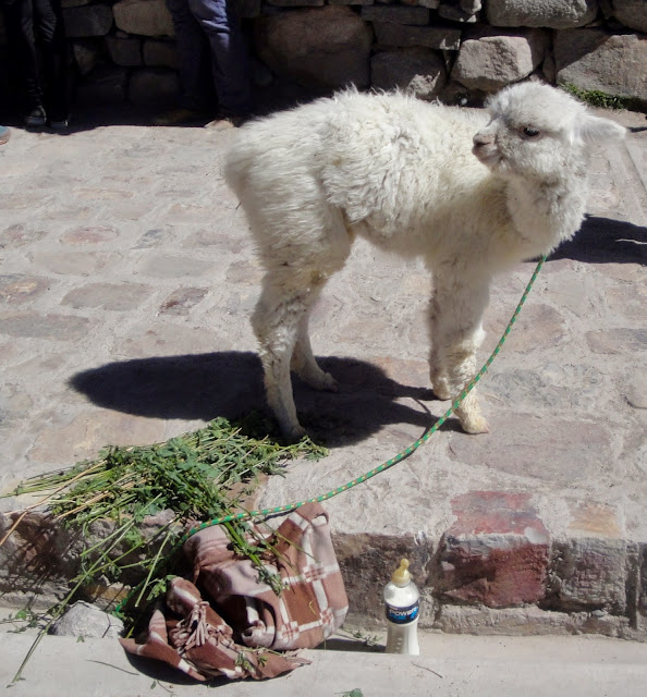
The hawkers also sell close encounters with various local animals: llamas, goats, hawks.
And of course cute baby llamas.
The villages at the mouth of the canyon are small and dusty, though there always a few satellite dishes on the roofs.
Basic services are available.
Life seems slower here.
Small though the towns may be, each has at least one church.
And the inside of those churches can be quite elaborate.
The sign of religious life are everywhere. Little shrines appear seemingly at random along the road.
Much of rural life hasn't changed for hundreds of years.
We stopped at some hot springs. O took a dip while I walked back up the steep, dusty road to take some shots of the beautiful little river valley.
I found a nice flat rock a little off the road where I could sit and meditate and just take in the amazing energy of this place.
My vantage point was just high enough to see the top of Sabancaya, a 19,000 foot volcano about 20 miles away. It is currently active, spewing a combination of gas, ash, and water vapor.
On the road back to Arequipa, we encountered a large herd of llamas.

As well as some rare, wild vicuñas. Vicuñas produce small amounts of extremely fine wool which is very expensive because the animal can only be shorn every three years, and has to be caught from the wild. The Inka valued vicuñas highly for their wool, and it was against the law for anyone but royalty to wear vicuña garments. Vicuñas were declared endangered in 1974, when only about 6,000 animals were left. Today, the vicuña population has recovered, but is still under threat.
The pilgrims left “apachetas”, or small stone towers to mark their visit and as homage to the Apus, or mountain gods. Thousands still can be seen, and they are augmented by those of modern tourists.
We found out only later that the road through Patapampa Pass is considered one of the world's most dangerous, not just because snow and ice storms can blow in unexpectedly, but because drivers sometimes pass out from lack of oxygen. O couldn't even get out of the bus to take in the view because she had a splitting headache from the altitude.
Breathing was very difficult at that altitude. Or it may have been the breathtaking views.
P.


1 comment:
A 16,000 plus, pass! And you could still breath, I'm stunned.
Post a Comment